Hiking in Altenberg: Walks to Geisingberg, Kahleberg and the Georgenfeld Moor
Viewpoint summits, flowering mountain meadows, a 10,000-year-old moor and traces of tin mining: around Altenberg the trailheads are so close together that you can often leave the car parked.
If you want to go hiking in Altenberg, you won't spend long getting to the start. The Geisingberg, the Kahleberg, the Galgenteiche ponds and the Altenberg Pinge are all just a few kilometres from the town centre, and the Georgenfeld Moor is a short bus ride further. Below are the walks we recommend to our guests most often – with honest figures for distance, time and difficulty.
Why Altenberg is a good base for hiking
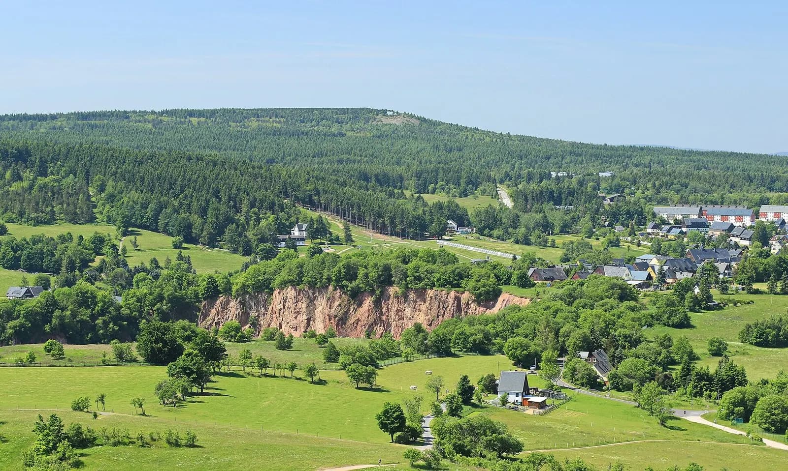
Altenberg sits on the crest of the Eastern Ore Mountains (Osterzgebirge), close to the Czech border. The landscape is more open than in many German uplands: mountain meadows, long stone walls built from field stones, spruce forest and small villages such as Geising, Schellerhau and Zinnwald-Georgenfeld in between. Many paths are well waymarked and link these places together.
Then there is the history. Tin was mined here for centuries, and you can still see it – at the Pinge, at the man-made Galgenteiche ponds and along old water ditches. Since 2019 the Altenberg-Zinnwald mining landscape has been part of the UNESCO World Heritage Site "Erzgebirge/Krušnohoří Mining Region".
For an overview of the whole trail network, hiking badges and guided walks, see the hiking page of Tourist Information Altenberg (in German). The tourist office itself is in the railway station building – handy, since several walks start right there.
Walks around Altenberg at a glance
| Walk | Distance | Time | Difficulty | Start |
|---|---|---|---|---|
| Geisingberg loop | approx. 8 km | approx. 2¼ h | easy to moderate | Altenberg station |
| Kahleberg and Galgenteiche | approx. 8.5 km | approx. 2¼ h | moderate | Altenberg station |
| Georgenfeld Moor (boardwalk) | approx. 1.2 km | short circuit | easy | Zinnwald-Georgenfeld |
| Lugstein walk | approx. 10 km | approx. 2½ h | easy to moderate | Zinnwald-Georgenfeld |
| 3-Peaks Tour (Geisingberg, Kohlhaukuppe, Kahleberg) | approx. 18.6 km | approx. 5 h | demanding | Altenberg station |
| Malter Reservoir loop | approx. 6.5 km | approx. 2 h | easy | Dippoldiswalde-Malter |
Figures are rounded and taken from the tourist office's route descriptions and common hiking portals. Depending on the variant and your breaks, it may take longer.
Geisingberg: lookout tower and mountain meadows
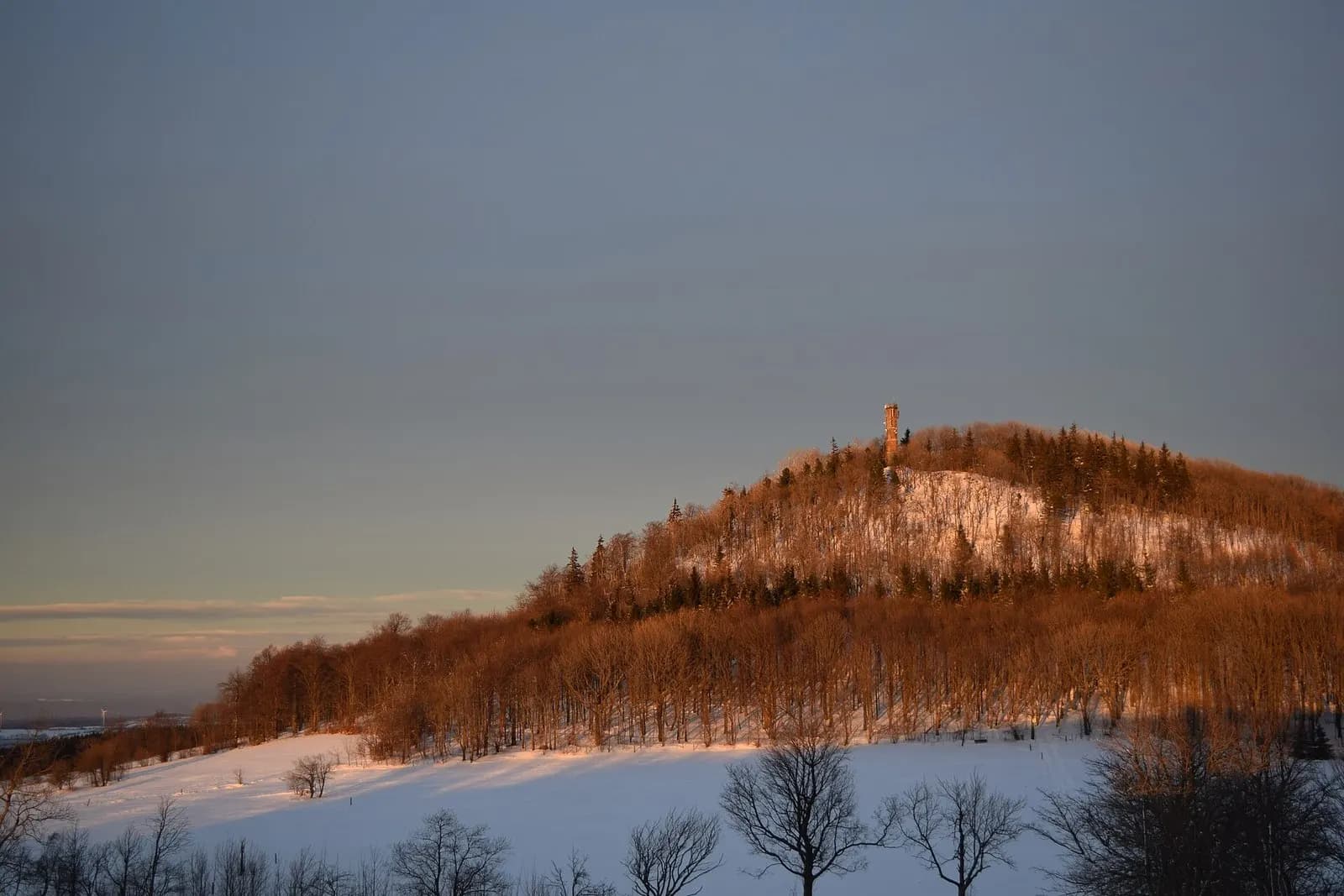
The Geisingberg is a basalt cone of around 820 metres between Altenberg and Geising – the closest summit to Altenberg. On top stands the Louisenturm: 18 metres high, 88 steps, opened in 1891. From the platform you look out over the whole area, and on clear days as far as Saxon Switzerland. The mountain inn is right next to the tower.
The tourist office describes a loop of about eight kilometres from Altenberg station with just under 190 metres of ascent. It climbs the Geisingberg, returns along the mining trail and passes the mining museum and the forest inn "Altes Raupennest". The route is also signposted as a winter walk.
The meadows on the Geisingberg are something special. The nature reserve now covers more than 300 hectares, and its species-rich meadows have been mown for hay for generations. In May and June they are full of globeflowers and tens of thousands of broad-leaved marsh orchids, followed later by spignel and wig knapweed. The conservation group Grüne Liga Osterzgebirge, which looks after many of the meadows, asks visitors to stay on the paths so flowers are not trampled and ground-nesting birds are not disturbed. You can read more on the Grüne Liga page about the Geisingberg reserve (in German).
Kahleberg and the Galgenteiche ponds
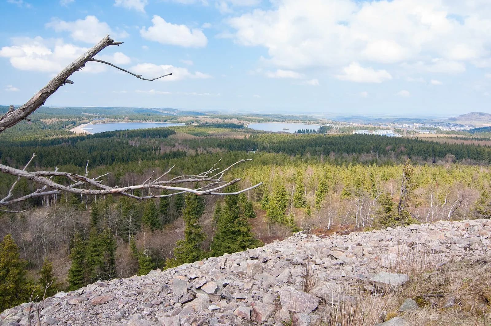
At 905 metres, the Kahleberg is the highest mountain in the Saxon part of the Eastern Ore Mountains, about two kilometres southwest of Altenberg. Instead of a tower, the summit has a boulder field and a wide view – in good visibility as far as the Elbe valley towards Dresden. The simple Kahlebergbaude hut on top reopened in 2023 after renovation.
On the way up you pass the Galgenteiche. The large pond, Großer Galgenteich, was built around 1550 to store water for tin mining, powering stamp mills, water wheels and ore washing. Today it supplies drinking water, so swimming is not allowed – but walking across the dam is. Loops from Altenberg station via the ponds to the Kahleberg and back are around eight to nine kilometres.
Altenberg Pinge: mining history on the edge of town
On 24 January 1620 the hollowed-out mine beneath Altenberg collapsed, and the tremor was felt as far as Dresden. The result is the Pinge, a crater roughly 400 metres across and up to 150 metres deep, right next to the town centre. You can't go into it, but a mining trail runs around the rim and shows how tin mining shaped the town. It is the shortest walk Altenberg has to offer – ideal on the day you arrive or when it rains.
Zinnwald-Georgenfeld: the moor and the Lugstein
The Georgenfeld Moor (Georgenfelder Hochmoor) lies right on the German–Czech border near Zinnwald-Georgenfeld, a village that belongs to Altenberg. The raised bog is about 10,000 years old, with peat up to five metres deep. It has been protected since 1926 and is one of the oldest nature reserves in Saxony.
You explore it on a boardwalk of about 1.2 kilometres with a viewing platform. Between dwarf mountain pines, cotton grass and open pools it is often strikingly quiet. Dogs on a lead are allowed; pushchairs and wheelchairs won't fit on the narrow boardwalk. Opening times and admission are listed on the Georgenfeld Moor page at altenberg.de. There is parking at the entrance to the village, and without a car you can reach Zinnwald by bus from Altenberg.
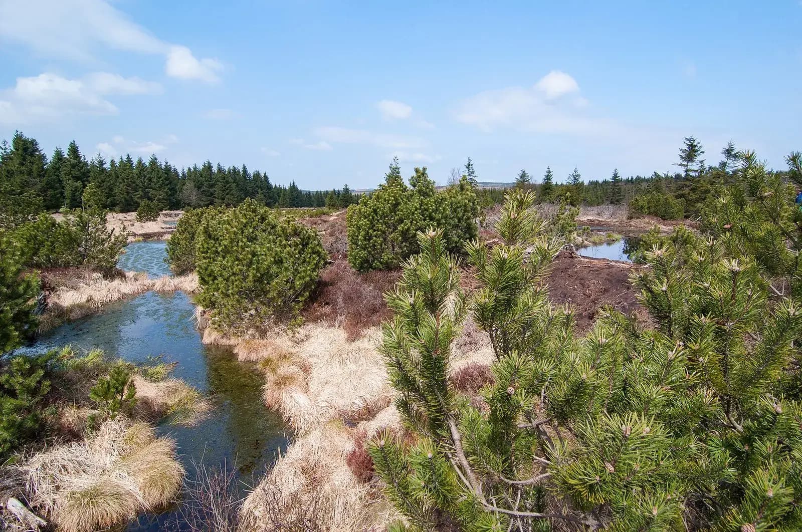
To turn the moor into a longer outing, add the Lugstein walk of about ten kilometres; the Großer and Kleiner Lugstein are both just under 900 metres high. Sure-footed hikers with good stamina also pass through here on the tourist office's 3-Peaks Tour: the loop starts at Altenberg station and runs over the Geisingberg and Kohlhaukuppe to Zinnwald-Georgenfeld, past the Lugsteine up the Kahleberg and back to Altenberg (18.6 kilometres, about 400 metres of ascent, around five hours).
Schellerhau: the botanical garden
Schellerhau lies between Altenberg and the Kahleberg. Its botanical garden, at 761 metres, shows around 1,400 plant species outdoors, arranged by their natural habitats. Gentians and alpine roses flower in May and June; from mid-August come autumn gentians and turning leaves. Dogs on a lead are welcome. The garden makes a good stop on a loop over the Kahleberg.
For long-distance hikers: the Kammweg and the "14 Eight-Thousanders"
The Kammweg Erzgebirge-Vogtland ridge trail starts in Geising, which is now part of Altenberg. It runs for 287 kilometres to Blankenstein in Thuringia and is certified as a quality trail by the German Hiking Association. Stage one (about 25 kilometres) crosses the Geisingberg, passes through Altenberg and continues over the Kahleberg and through Rehefeld-Zaunhaus to Holzhau. So you can join it in the middle of town and walk just part of it; we describe the stage kilometre by kilometre in the Kammweg from Geising. The season runs from May to October; the trail is not cleared in winter. Stage details are on Saxony Tourism's Kammweg page.
A local curiosity is the "14 Eight-Thousanders of the Eastern Ore Mountains": 14 summits higher than 8,000 decimetres – in other words over 800 metres. A trail of about 68 kilometres links them. Collect a stamp on every summit and you can exchange your card for a summit T-shirt at Tourist Information Altenberg.
Around Dippoldiswalde: Malter Reservoir and Rabenauer Grund
About 20 kilometres north of Altenberg lies Dippoldiswalde, where the landscape becomes gentler and lower. The Malter Reservoir is just outside town. A loop of about 6.5 kilometres follows the shore, and in summer you can swim there too.
From Malter, a path follows the Rote Weißeritz river through the Rabenauer Grund gorge to Freital-Hainsberg, about twelve kilometres in total. The valley is narrow and rocky, and you pass the old Rabenau mill (Rabenauer Mühle) on the way; its hotel and restaurant have been closed since 2022, and only a beer garden opens in good weather. To get back, take the Weißeritztalbahn, a narrow-gauge steam railway between Freital-Hainsberg, Dippoldiswalde and Kurort Kipsdorf. It's best to check the timetable in advance.
By the way: the Lehnmühle Reservoir is often listed as an Altenberg sight, but it actually lies on the Wilde Weißeritz between Dippoldiswalde and Frauenstein. Like the neighbouring Klingenberg Reservoir, it supplies Dresden with drinking water, so swimming is not allowed. An educational trail with 16 stations connects the two reservoirs.
When is the best time to hike?
- May and June: meadow flowers on the Geisingberg, alpine plants in the botanical garden, fresh green in the moors.
- July and August: haymaking on the meadows and long evenings on the summits. On hot days the crest is usually a little cooler than Dresden.
- September and October: clear long-distance views, rowan trees heavy with red berries – the signature tree of the Ore Mountains – and autumn colours. The tourist office often runs guided hiking weeks at this time; current dates are on altenberg.de.
- Winter: signposted winter walks, for example up the Geisingberg. For more cold-season ideas, see Winter days in Altenberg.
Getting there without a car and practical tips
- Train: The Müglitztalbahn (RB 72) runs from Heidenau, where the S-Bahn from Dresden stops, to Altenberg in just under an hour. At weekends and on public holidays there is also a direct train (RE 19) from Dresden.
- Bus: The PlusBus 360 links Dresden main station with Altenberg via Dippoldiswalde. From Altenberg, line 398 continues via Zinnwald.
- Parking: For the Geisingberg loop, the tourist office recommends car park P2 at the Erlebnisberg. For the moor, there is parking at the entrance to Zinnwald-Georgenfeld.
- Gear: On the crest the weather changes quickly and it is often windier than in the valleys. Sturdy shoes and a rain jacket belong in every rucksack. Mobile reception can be patchy away from the villages, so an offline map helps.
- Nature protection: In the nature reserves, stay on marked paths and keep dogs on a lead.
After a long walk, the regional food tastes especially good. Find out what's on the menu in Discover Ore Mountain cuisine.
Staying close to the trails
In Altenberg we rent out eight rooms at Dresdner Straße 10, each with its own bathroom and WC, seven for up to two guests and one for up to three, from €70 per night. From here you can set off on foot to the Geisingberg, the Pinge or the Kahleberg.
If you need more space or prefer to cook for yourself, we have two apartments for up to four and five guests respectively at Bahnhofstraße 15 in Dippoldiswalde, also from €70 per night – a good base for the Malter Reservoir and the Rabenauer Grund.
You book directly with us by phone or WhatsApp on +49 1514 1213283 or +49 1525 1644356. For more ideas for your days in the Eastern Ore Mountains, see our regional guide.
Frequently asked questions
How high is the Kahleberg near Altenberg?
The Kahleberg is 905 metres high, the tallest mountain in the Saxon part of the Eastern Ore Mountains. It lies about two kilometres southwest of Altenberg, and the Kahlebergbaude hut on the summit reopened in 2023 after renovation.
Can I go hiking around Altenberg with my dog?
Yes. Dogs must be kept on a lead in the nature reserves. According to the town of Altenberg, dogs on a lead are explicitly welcome in the Georgenfeld Moor and in the Schellerhau Botanical Garden.
How do I get to Altenberg for hiking without a car?
Take the Müglitztalbahn (RB 72) from Heidenau, where the S-Bahn from Dresden stops; the ride takes just under an hour. The PlusBus 360 also runs from Dresden main station via Dippoldiswalde to Altenberg.
When do the mountain meadows on the Geisingberg bloom?
The main flowering is in May and June, when globeflowers and orchids such as the broad-leaved marsh orchid are out. Haymaking starts from late June, depending on altitude.
Is the Georgenfeld Moor suitable for pushchairs?
No. The boardwalk is about 1.2 kilometres long and only around one metre wide, so it is not suitable for pushchairs or wheelchairs. There is an entrance fee; current times are listed on altenberg.de.